Campus GIS — Interactive University Campus Maps
Screenshots show campusplan.aau.at (current successor site) © Universität Klagenfurt — original campus-gis.aau.at built by Gomogi
Overview
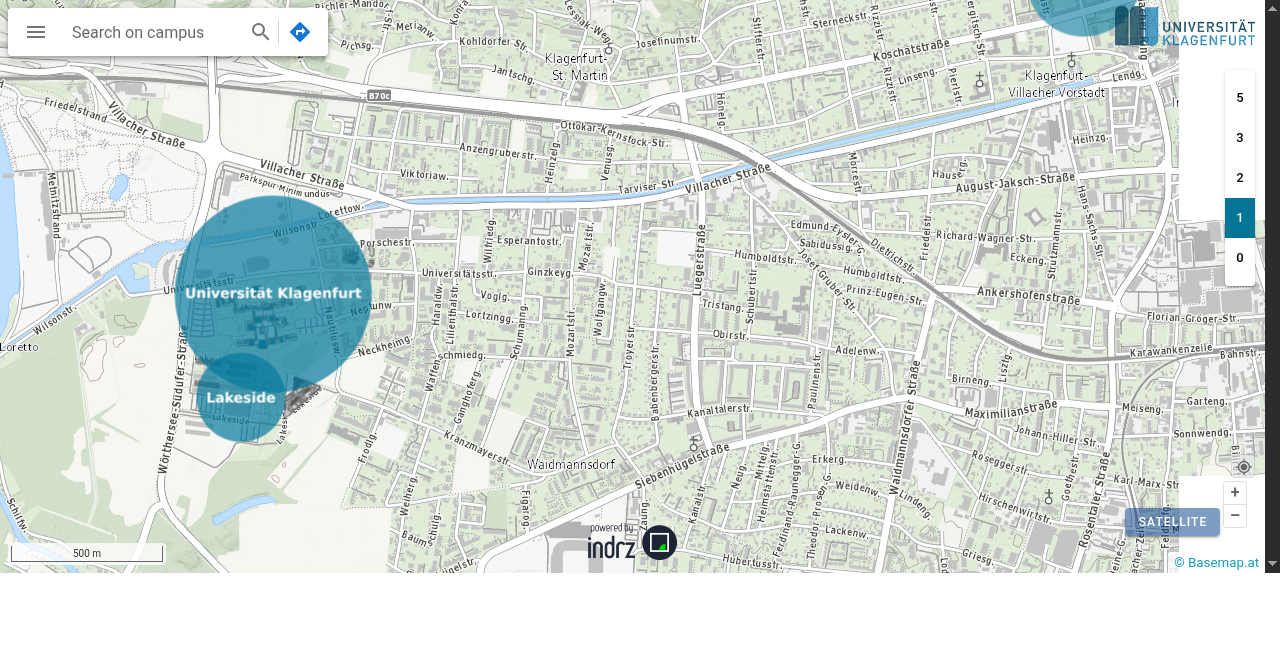
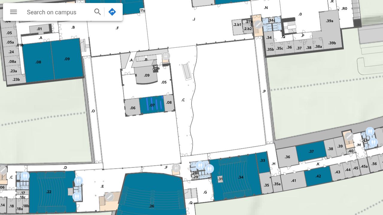
Campus GIS is an interactive, browser-based campus map system built for Austrian universities. It lets students, staff, and visitors navigate university buildings floor by floor, search for rooms and facilities, and get oriented on campus — all in the browser, no app required.
I built this as a developer at GOMOGI Michael Diener — a small software company specialising in geographic information systems. Two deployments were created:
- Alpen-Adria-Universität Klagenfurt — originally at
campus-gis.aau.at, now at campusplan.aau.at - WU Wien (Wirtschaftsuniversität Wien) — originally at
gis.wu.ac.at, now at campus.wu.ac.at
My Role
I was the primary developer at Gomogi responsible for building and maintaining both deployments. The work spanned from a freelance engagement in 2008 through a part-time position from January 2009 to February 2013.
What It Does
- Renders an interactive, zoomable campus map using OpenStreetMap data
- Floor-by-floor navigation for multi-storey university buildings
- Room/location search by name or function
- Covers multiple campus locations (main campus, Lakeside Park at AAU; main WU campus at WU Wien)
Tech Stack
- Frontend: JavaScript, OpenLayers (open-source mapping library)
- Map data: OpenStreetMap (CC-BY-SA)
- Backend: PHP
- Hosting: On-premise at the respective universities
Timeline
- 2008 — First freelance engagement at Gomogi
- 2009–2013 — Part-time employee; built and maintained both campus GIS deployments
- 2026 — Both universities still run campus map systems at the same URLs (now powered by indrz)